
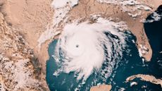
Hurricane Dorian has left a trail of death and destruction after stalling over the northern Bahamas for more than 24 hours earlier this week.
At least 20 people have been confirmed dead and many more are missing after the slow-moving storm battered the islands with wind, rain and surging seas. An estimated 13,000 homes were destroyed or severely damaged, and around 70,000 people left in need of urgent aid, according to United Nations officials.
Subscribe to The Week
Escape your echo chamber. Get the facts behind the news, plus analysis from multiple perspectives.

Sign up for The Week's Free Newsletters
From our morning news briefing to a weekly Good News Newsletter, get the best of The Week delivered directly to your inbox.
From our morning news briefing to a weekly Good News Newsletter, get the best of The Week delivered directly to your inbox.
Create an account with the same email registered to your subscription to unlock access.
-
 Nuclear near-misses
The Explainer From technical glitches to fateful split-second decisions, the world has come to the brink of nuclear war more times than you might think
-
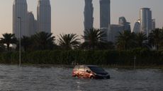 What is cloud seeding and did it cause Dubai's severe rainfall?
The Explainer The future is flooded
-
 American Airlines pilots are warning of a 'significant spike' in safety issues
In the Spotlight The pilot's union listed 'problematic trends' they say are affecting the airline's fleet


-
 It might be time to add a new hurricane category
Under the Radar Any way the wind blows
-
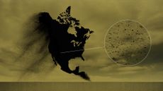 The microplastics hurricanes blowing across North America
Under the Radar New research confirms global pervasiveness of harmful microplastic pollution
-
 What to expect from an El Niño winter
The Explainer Things might be different thanks to this well-known weather phenomenon
-
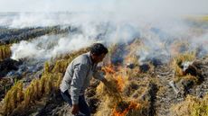
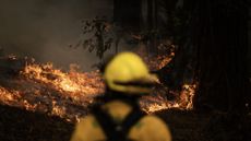 What’s fuelling the world’s recent wildfires
feature New research says climate change is fanning the flames as more intense fires continue to spread
-
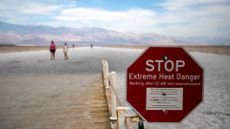 The hottest July: America’s Southwest boils in the heat
feature Phoenix residents have suffered burns after falling on the city’s scalding roads
-
 How to make homes cooler without cranking up the air conditioning
feature Air conditioners often become the default solution when temperatures rise but they’re not the only answer
-
 Why is extreme weather causing fewer deaths?
feature The changing climate is leading to more disasters but warnings and management of impacts is improving
-
 How La Niña and El Niño affect the weather
feature Extreme conditions could worsen as global cooling pattern ends


